Eagle Peak looks like the head of an eagle scowling along the Main Divide when viewed from high on Mt Thomson’s east face or the upper Donne Glacier.

Routes
| Reference | Title | Grade | Length | Pro | Quality | Alert | Operations |
|---|---|---|---|---|---|---|---|
| 2.51 | 2.51South Ridge, III,2+ | III,2+ | 0m | ||||
|
Climb via the Main Divide from Maunga Ma.
|
|||||||
| 2.52 | 2.52East Face, V,3 | V,3 | 0m | ||||
|
From the Frind-Mueller confluence, ascend part of the way up the true right edge of the lower Frind Glacier, then climb left along rock ledges. Just before reaching the Ngakanohi Glacier turn right to climb up a narrow S-shaped gully that leads to a large, wide rock buttress. Climb the rock (there are several possible options) to gain a vague snow and rock rib to the right of the broad gully that descends from below the summit. Climb the rib directly to the summit.
|
|||||||
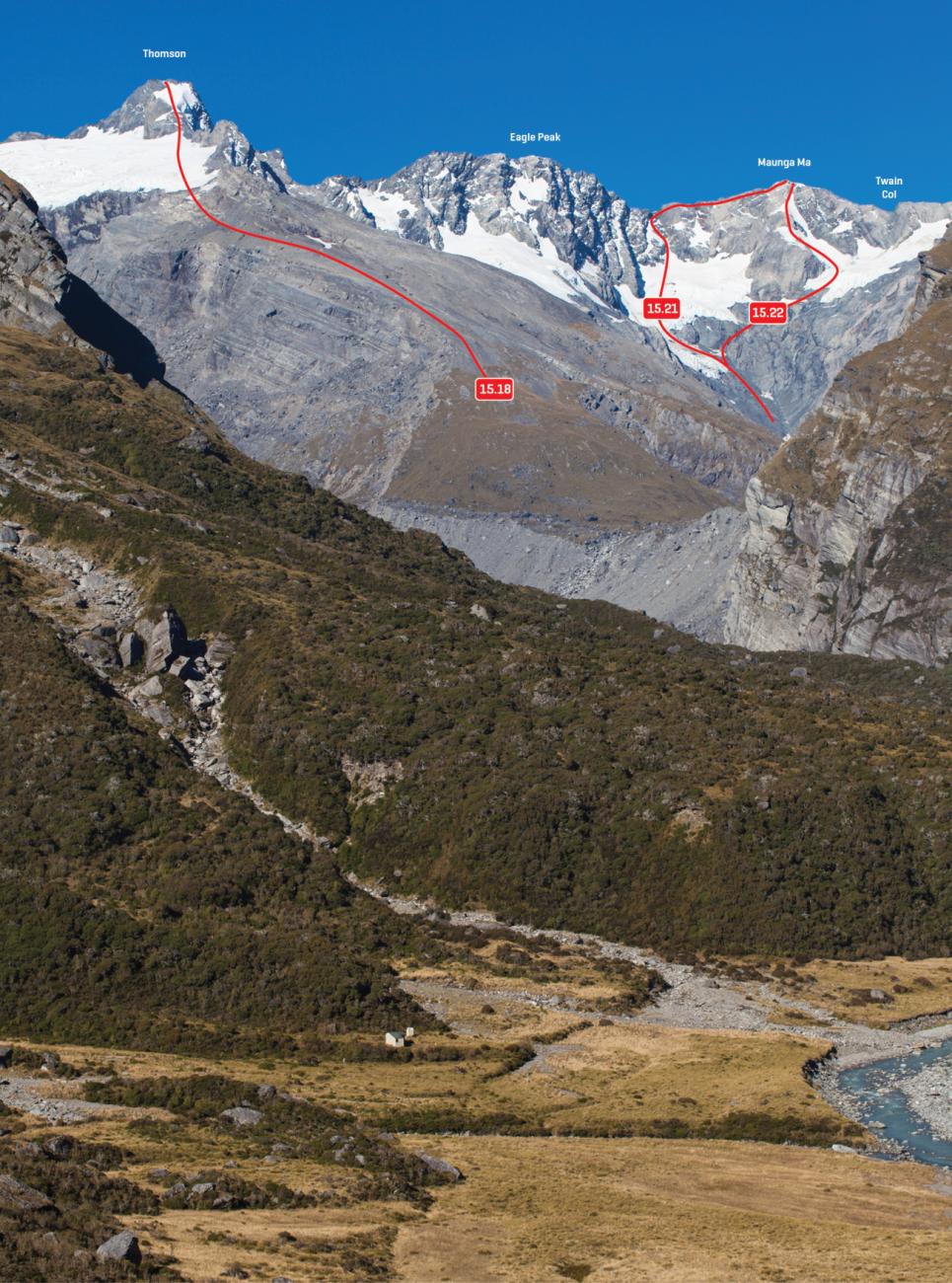
| 15.20 | 15.20West Face, III,3 | III,3 | 0m | ||||
|
From the Fitzgerald lake, ascend towards the 2416m col until about 1950m, then traverse left beneath bluffs onto the large snowfield below Eagle Peak. In 1953 this snowfield was continuous from Thomson to Eagle Peak, and the first ascent party reported that a rock scramble took them from the head of the snow to the flat summit. It appears that several additional rock steps now exist due to recession of the snow and ice, but a couple of moderate routes to the summit appear feasible.
|
|||||||
Images