Type
Mountain
Altitude
2046m
Part of
na
Map
Accessed from
Image
Routes
| Reference | Title | Grade | Length | Pro | Quality | Alert | Operations |
|---|---|---|---|---|---|---|---|
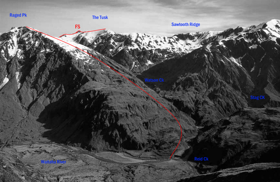
| FS | FSFrom the South, 1- | 1- | 0m | ||||
The Tusk is easily approached along the ridge from Raged Peak and the Reid–Stag Creek forks. |
|||||||
| Dickie Ridge, 1+ | 1+ | 0m | |||||
This long ridge can be traversed from Dickie Spur Hut to the Tusk but the rock is loose, there |
|||||||
| From Top Tuke Hut, 1+ | 1+ | 0m | |||||
Head up valley from the hut and take the true-left lower fork that is closest to the 1020-metre |
|||||||
Comments
Attribution
Yvonne Cook and Geoff Spearpoint,
in association with the Canterbury Mountaineering Club
in association with the Canterbury Mountaineering Club
UUID
de378083-331b-4484-8f1a-19473da5af4c