Type
Altitude
2089m
Part of
na
Lat/lon
-43.455972,170.414085, NZ Topo Map
Topo50
BX16 908 853
Accessed from
Routes
| Reference | Title | Grade | Length | Pro | Quality | Alert | Operations |
|---|---|---|---|---|---|---|---|
| Original Route, 1 | 1 | 0m | |||||
This rock peak can be climbed up extensive slabs from the stream below Lake Barrowman. Snow on the slabs can be a significant avalanche hazard. |
|||||||
| West Face | 0m | ||||||
A route on slabs from Barrowman Stream. |
|||||||
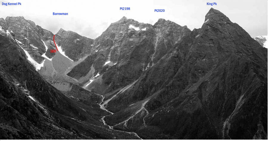
| SER | SERSouth East Ridge, 2 | 2 | 0m | ||||
From the South Butler Valley, head straight up a snow gully then rock east of Mt Barrowman towards a col immediately south-east of Mt Barrowman. The last part to the col is difficult (slabs). Above, about five pitches (the first exposed and on loose rock) lead up the ridge to the summit. |
|||||||
Comments
Attribution
Yvonne Cook and Geoff Spearpoint,
in association with the Canterbury Mountaineering Club
in association with the Canterbury Mountaineering Club
UUID
e5cda14d-dfa0-4f0c-9563-adbd252ff225
