https://www.facebook.com/media/set/?set=a.367499855814.192983.208069165814&type=3
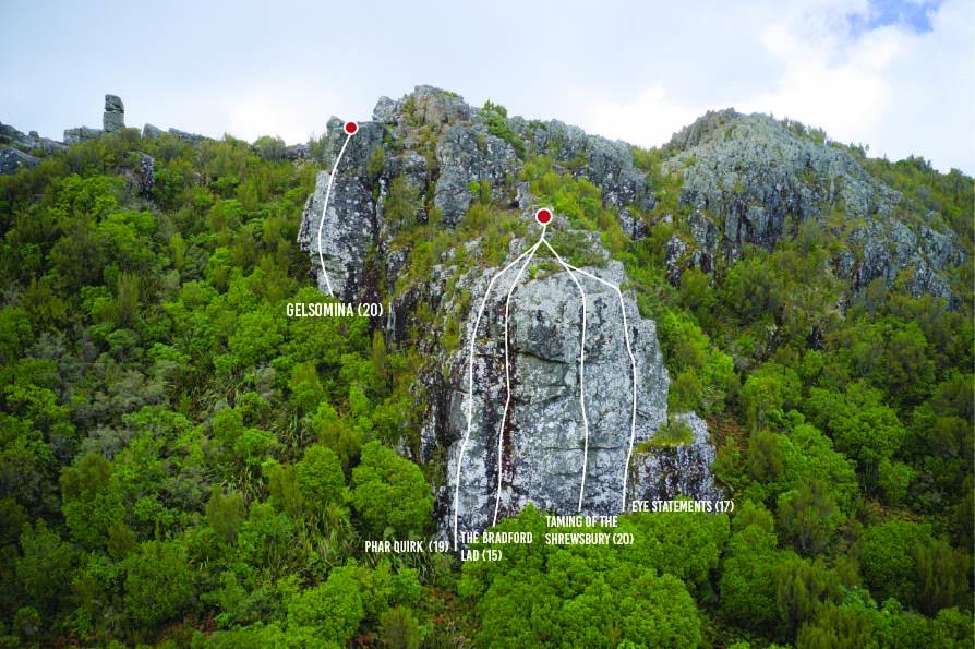
No topo. as of yet. 2 trad. routes, but everything else has been bolted, aside from the belay/anchor. Left hand trad. route (15) tends to be wetter than the rest of the crag. Right hand trad. route goes at 17. All of the bolted routes are around grade 18-20.

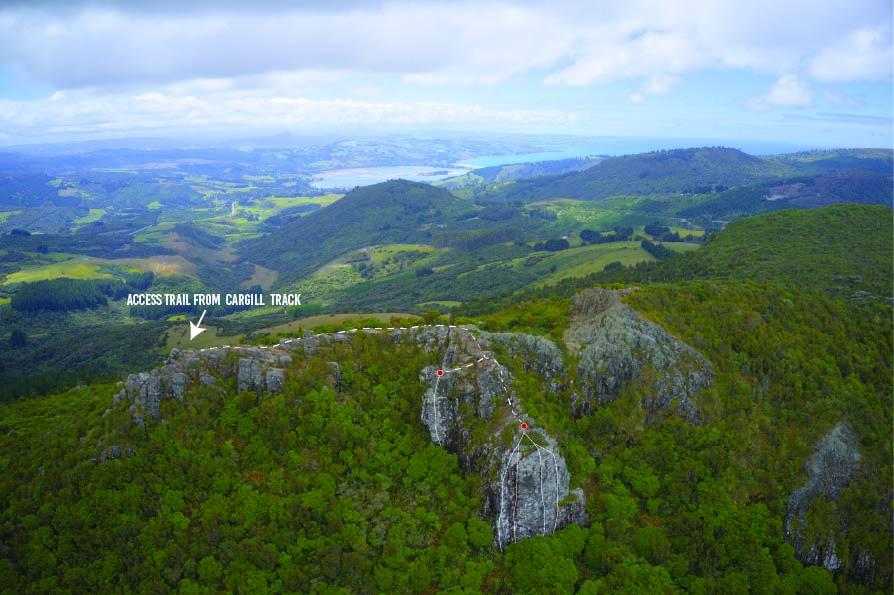
10-15min. walk from Mount Cargill carpark: walk downhill about 5-10 min. from the carpark to the track junction to the Organ Pipes and Buttars Peak, take a left and follow the sign to Buttars Peak: http://www.dunedin.govt.nz/facilities/walking-tracks/skyline-walks The routes are on the other side of the rock from the approach. Build a natural anchor and abseil to the base of the crag.
Routes
| Reference | Title | Grade | Length | Pro | Quality | Alert | Operations |
|---|---|---|---|---|---|---|---|
| Gelsomina , 20 | 20 | 0m | 3 |
||||
|
|||||||
| Phar Quirk, 19 | 19 | 0m | 2 |
||||
|
Nice arete
|
|||||||
| The Bradford Lad, 15 | 15 | 0m | |||||
Mossy, slimy crack. |
|||||||
| Taming The Srewsbury, 20 | 20 | 0m | 3 |
||||
|
Up the main face
|
|||||||
Images
