St Arnaud Range
Routes
| Reference | Title | Grade | Length | Pro | Quality | Alert | Operations |
|---|---|---|---|---|---|---|---|
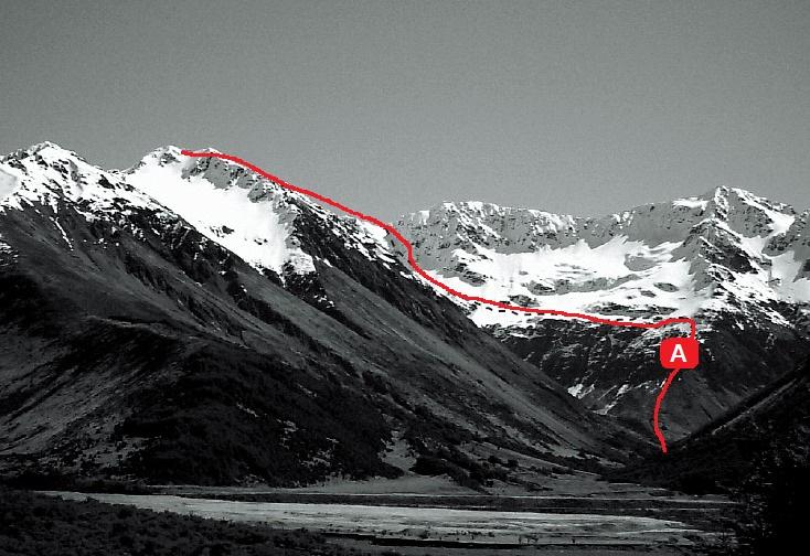
| A | ANorth East Ridge Grade 2, 2 | 2 | 0m | ||||
Via Rainbow River. Climb a broad, scrubby ridge from the junction of the north and south branches of the Rainbow, then sidle along a shelf (great campsite) and diagonally up narrow exposed platforms to a col north of the peak. Follow the range to the summit. Beware of avalanches on all slopes. |
|||||||
| West Face / North Ridge, 1 | 1 | 0m | |||||
Without crossing the swingbridge, follow the old track on the true left. From a large boulder at the southern end of the large clearing east-southeast of Mt Franklin, climb through forest to the bushline. Sidle upwards, crossing into a basin with a large tarn. Climb scree towards a col north-east of Mackay (map ref. M30/878040), and along the ridge. |
|||||||
| South Ridge Grade 2+, 2 | 2 | 0m | |||||
A steep ridge rising from the northern pass (see route 6.06) can be bypassed via gullies falling to the source tarn of the East Sabine. Climb a large couloir at the head of the tarn, up a rock step and onto Peak 2180m. Gendarmes on the narrow main ridge to the summit can be sidled or climbed over. |
|||||||