Type
Altitude
2517m
Part of
Has the Low Peak (2486m).
Lat/lon
-43.4182251,170.5196373, NZ Topo Map
Topo50
BX17 992 898
Accessed from
Routes
| Reference | Title | Grade | Length | Pro | Quality | Alert | Operations |
|---|---|---|---|---|---|---|---|
| SR | SRSouth Ridge | 0m | |||||
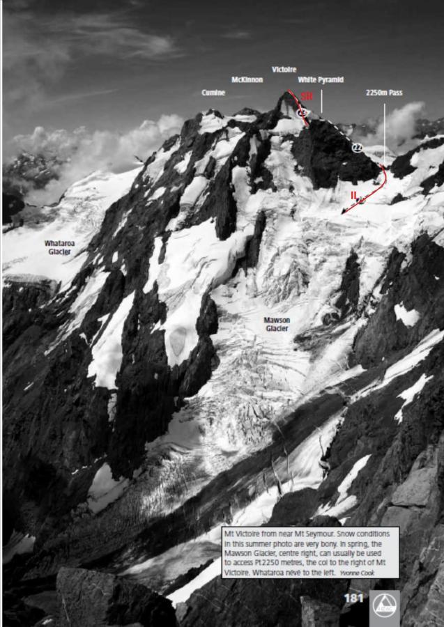
Ascend snow slopes to the north of White Pyramid from the Neish Plateau and climb the snow and rock ridge south of the peak. |
|||||||
| From Neish Plateau | 0m | ||||||
From an upper basin of the Neish Plateau, head up snow slopes to the col between the high and low peaks. The Low Peak is now accessible, but from here the high peak is somewhat more difficult, on loose rock. |
|||||||
| IL | ILFrom Ice Lake, 2- | 2- | 0m | ||||
Up the Mawson Glacier to the Divide pass at 2250 metres, then continuing over White Pyramid and the South Ridge. This climb was done in good spring snow conditions as a three-day Labour Weekend trip from Wellington ; attempts en route to hop ice floes along the lake edge failed, with a dunking for one party member. |
|||||||
Comments
Attribution
Alex Palman, Yvonne Cook and Geoff Spearpoint,
in association with the Canterbury Mountaineering Club
in association with the Canterbury Mountaineering Club
UUID
e2017852-49eb-478e-b93c-2ceaa47f6ab4
