Type
Altitude
2102m
Part of
na
Lat/lon
-43.064185,171.219006, NZ Topo Map
Topo50
BV19 550 305
Accessed from
Routes
| Reference | Title | Grade | Length | Pro | Quality | Alert | Operations |
|---|---|---|---|---|---|---|---|
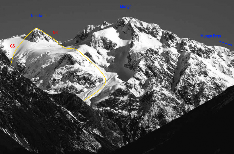
| GS | GSFrom Gibson Stream | 0m | |||||
From Gibson Stream, climb through scree and steep tussock east of the bluffs and waterfall draining the basin below Mt Treadwell. From this basin several options exist to the summit. |
|||||||
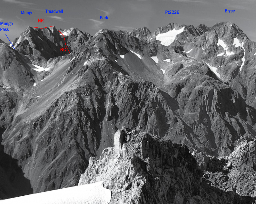
| NR | NRNorth Ridge | 0m | |||||
The North Ridge can be reached via a traverse from Mungo Pass, or from the basin east of the peak and a small glacier between Mt Treadwell and Mungo Peak. . |
|||||||
| BC | BCFrom Brunswick Creek, 1 | 1 | 0m | ||||
From gravel in the upper basin of Brunswick Creek, head south-east up a scree gully that leads to a final short scramble on rock. |
|||||||
Images
Comments
Attribution
Yvonne Cook and Geoff Spearpoint,
in association with the Canterbury Mountaineering Club
in association with the Canterbury Mountaineering Club
UUID
928c8492-07ff-4a4c-a62a-8cb88dabc5b7

