Type
Altitude
2304m
Part of
Lat/lon
-43.16693706,171.03821592, NZ Topo Map
Topo50
BW18 405 188
Accessed from
Routes
| Reference | Title | Grade | Length | Pro | Quality | Alert | Operations |
|---|---|---|---|---|---|---|---|
| From South Mathias River | 0m | ||||||
Follow the South Mathias River, climbing scree and snow slopes immediately south of Bonds Peak. The bluffs are passed without difficulty – above the bluffs take a long snow slope to the summit rocks then up some tricky slabs to the top. |
|||||||
| South Couloir, 3 | 3 | 0m | |||||
From the north side of the South Mathias River, climb gentle slopes to the base of an obvious couloir and follow this almost directly to the summit. |
|||||||
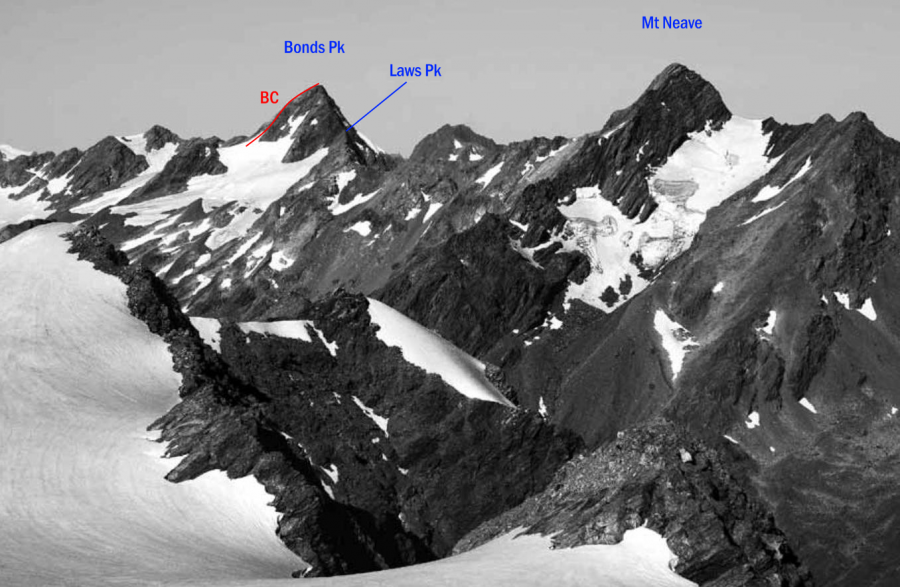
| BC | BCFrom Bond Creek, 1 | 1 | 0m | ||||
A small glacier gives easy access from the north. A straightforward scramble follows on rock and scree. |
|||||||
Comments
Attribution
Yvonne Cook and Geoff Spearpoint,
in association with the Canterbury Mountaineering Club
in association with the Canterbury Mountaineering Club
UUID
fbc7885a-5fba-482f-9278-69c8cd719a63
