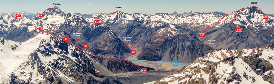
Named after Captain Sibbald, the first runholder at Lilybank Station, Mt Sibbald was first climbed by Edgar Williams and William Kennedy in 1917 from Lucifer Flat in the Godley Valley.
A successful climb from the glacier on the northern slopes (now the standard route) was made in 1934 by C N Johnson, H J Newberry and I Powell from McKinnon Stream (a tributary of the Godley River), but this route is now usually reached from the Macaulay Valley.
Mt Sibbald is relatively easy to reach and, being east of the Main Divide, is away from the worst of the westerly weather, making the climb a popular two-day trip. The usual approach is from Macaulay Hut although a camp further upstream or a high bivvy may be beneficial as the summit is a 1700-metre climb from the Macaulay riverbed – there is good camping at the tarn in Upper Tindill Stream. Mt Sibbald has three peaks. A climb of the northern summit is straightforward and gives good views.
Reaching the higher south summit requires some exposed, delicate footwork along a rotten and towered ridge and this frequently causes more cautious groups to turn back. A rope might be helpful.
Map
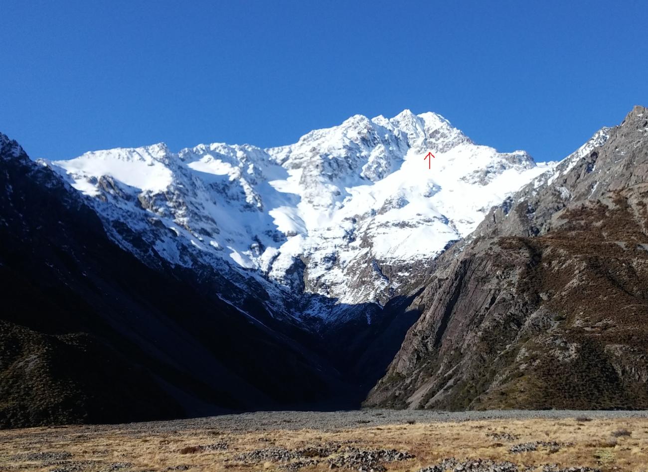
Looking east to D'Archiac and the Sibbald Range, December 2016
Routes
| Reference | Title | Grade | Length | Pro | Quality | Alert | Operations |
|---|---|---|---|---|---|---|---|
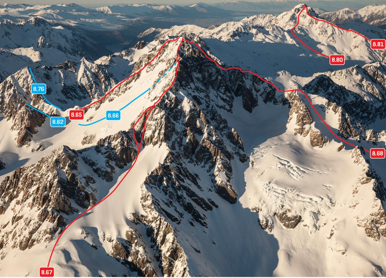
| 8.80 | 8.80North Ridge, II,2+ | II,2+ | 0m | ||||
|
The saddle between McKinnon Stream and Tindall Stream can be reached from either the Godley or Macaulay valleys. If the upper Tindall Glacier is cut up, take a hard scramble up bluffs on the true right. Then follow the ridge and steep glacier slopes south to the north summit. If the icefall is too broken it can be bypassed by climbing Pt 2516m. The traverse from the north to the main (south) summit is mostly rock, and has a couple of difficult spots where some parties will want a rope.
|
|||||||
| 8.81 | 8.81North West Ridge, II,2+ | II,2+ | 0m | ||||
|
From McKinnon Stream, climb up steep scree to a saddle west of Pt 1991m, then follow the ridge, avoiding obstacles on the northern side. The scrambling gets more interesting at Pt 2516m. Then travel on snowfields and scree to join the original route to the summit.
|
|||||||
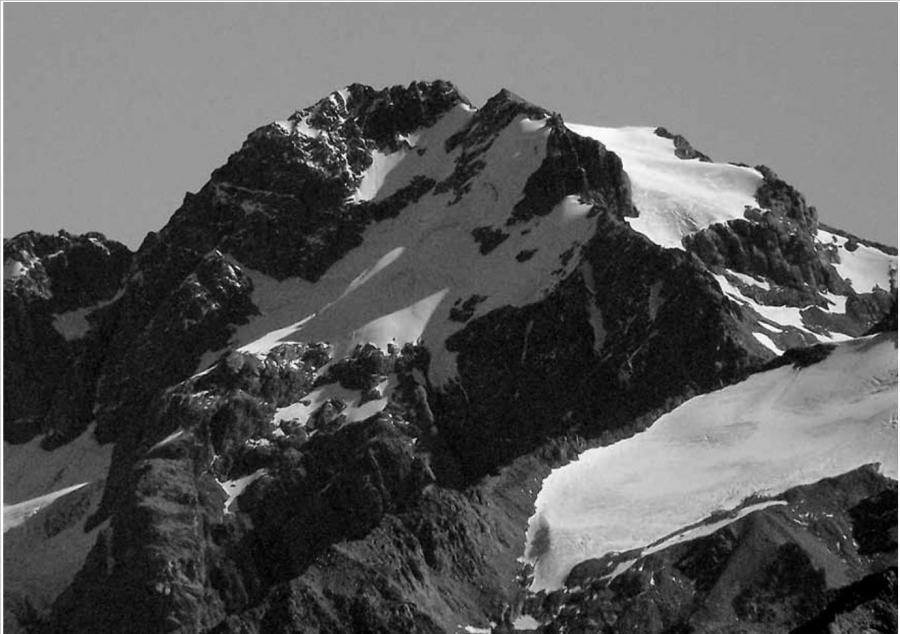
| Bohemoth's Corridor, 2+ | 2+ | 300m | |||||
|
This route climbs a 300m couloir through centre of West Face buttress. It has one mixed step to begin with (M3) and continues as a snow gully with some more mixed terrain on exit. It tops out closer to South rather than North summit of Mt. Sibbald. Some route finding required to exit Lucifer stream. Descended west face.
|
|||||||
| West Face, II,2+ | II,2+ | 0m | |||||
|
The first ascent of Mt Sibbald was from Lucifer Flat but the the exact route is unknown.
|
|||||||
| 8.83 | 8.83South West Ridge, II,3 | II,3 | 0m | ||||
|
Gain the base of the upper ridge using one of the following options:
|
|||||||
| South Face, IV,4+ | IV,4+ | 0m | |||||
|
From the head of Godley River North Branch, this route ascends the steep buttress to the east of the hanging glacier to Pt 2633m, then up the South East Ridge to the summit. The buttress is wide and complex, and many different routes could be taken. The first ascentionists stayed near the crest, linking snow gullies with occasional steep rock steps.
|
|||||||
| South East Ridge, III,3 | III,3 | 0m | |||||
|
Climb easily to the saddle northwest of Pt 2124m, then follow the ridge crest. The ridge rises in a series of steps to the final summit block, which involves steep, rotten rock.
|
|||||||
Images
CW Alps 2009 (Geoff Spearpoint, Yvonne Cook, CMC)