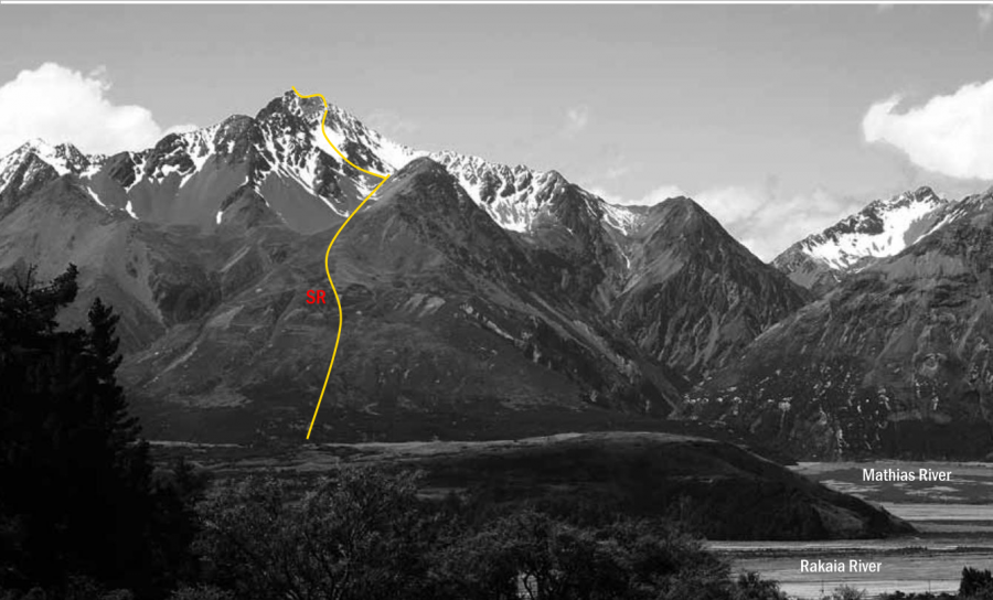
From the foot of the broad slopes west of Chimera Stream, link a network of open clearings and
animal tracks through manuka scrub (not as bad as it looks) to the broad tussock slopes leading
to the col between Pts 1791 metres and 1971 metres. From the basin north of this col follow a
gully that leads to the ridge north of Pt 2008 metres. Climb the rocky ridge to the broad flat
summit, avoiding obstacles on the east side.