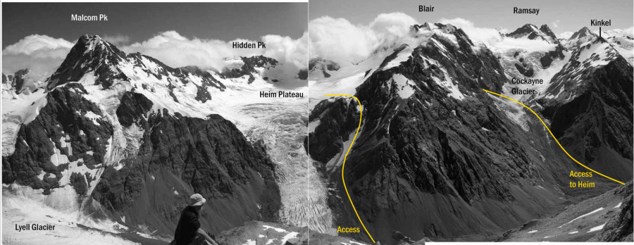
Heim Plateau provides access from the head of the Rakaia River to several peaks on the Divide. The
icefall draining the plateau is time-consuming to climb and often impassable – the most direct route to
the plateau climbs Rift Couloir, a mostly snowy gully on the true left of the icefall, joining the plateau
on a broad shoulder on the south-west ridge of Pt 2253 metres. Rift Couloir is a natural funnel for rock
fall, and with decreasing snow cover a small rock step becomes exposed about 150 metres below the
plateau. A seldom-used alternative access can be made via rocks immediately east of the icefall via a
crack and chimney (watch for rock fall).
A longer route reaches the plateau via the Cockayne Glacier and a side glacier that leads to a col on
to the plateau. However, the side glacier is steep near the top and rock fall may occur off Blair Peak.
in association with the Canterbury Mountaineering Club