Stewart Saddle was crossed from the Godley Glacier to Bettison Stream by D G Boddy, B J McGlinchy and G Willberg on 7 January 1958.
Map
From the Godley: Grade II, 2, route 8.51 on topo. The Amherst Glacier is usually straightforward to ascend near the true left. Easy snow slopes lead from the upper glacier to Stewart Saddle.
Descending to Bettison Stream: On the Bettison side, sidle across to the rock rib (BX17 047 890) on the true right of the glacier above the icefall and descend this on bedrock (or snow nearby) to the valley floor. Some moderately steep sidling is required to access the rib from the upper glacier, and there is a steep section at around 1400m.
In spring, a snowcone makes this latter section straightforward, but by February the slope is cut by a waterfall and the alternative slopes comprise steep, crumbly rock. Below here, gravel and boulders lead down to long tussock in the Bettison Basin. See Perth River for travel in the Bettison to Scone Hut.
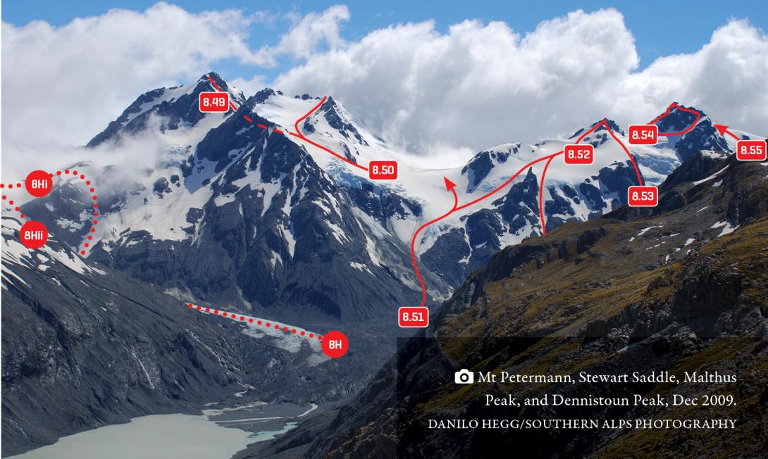
Sealy Pass, Mt Petermann, Stewart Saddle, Malthus and Dennistoun Peaks, December 2009
CW Alps 2009 (Geoff Spearpoint, Yvonne Cook, CMC)