Type
Mountain
Altitude
2346m
Part of
Map
Accessed from
Image
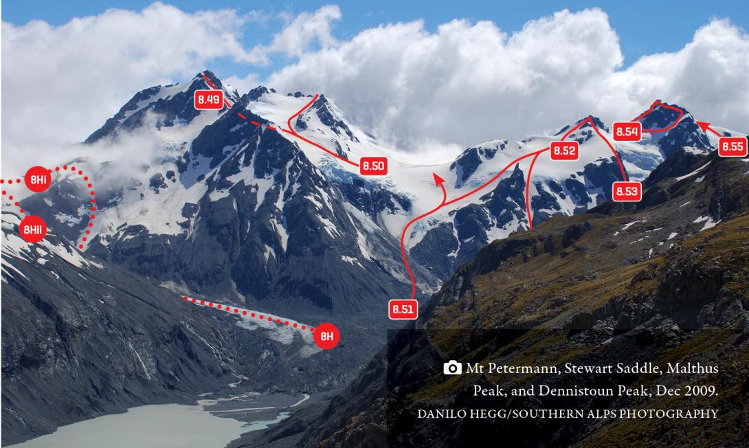
Caption
Sealy Pass, Mt Petermann, Stewart Saddle, Malthus and Dennistoun Peaks, December 2009
Rights credit
Danilo Hegg/Southern Alps Photography
Routes
| Reference | Title | Grade | Length | Pro | Quality | Alert | Operations |
|---|---|---|---|---|---|---|---|
| 8.48 | 8.48West Ridge, II,2+ | II,2+ | 0m | ||||
|
From Sealy Pass, traverse along the rock of the Main Divide, then climb snow slopes west of the summit.
|
|||||||
| From upper Scone Creek | 0m | ||||||
From the top of the lake in the head of the Scone, follow a snow gully up heading east. Near the summit gain a snow ridge and continue south east. |
|||||||
| 8.49 | 8.49East Face, II,3 | II,3 | 0m | ||||
|
A moderately steep snow climb from the Amherst Glacier.
|
|||||||
Comments
This place appears in
Attribution
ATP 2018 (Rob Frost)
CW Alps 2009 (Geoff Spearpoint, Yvonne Cook, CMC)
CW Alps 2009 (Geoff Spearpoint, Yvonne Cook, CMC)
UUID
4760c431-206d-4b98-a72a-eaad234fc170