
Mt Byrne

Type
Mountain
Altitude
1448m
Part of

Mt Byrne is a peak near Locke Stream Hut on the upper Taramakau River

Lat/lon
-42.74940728,171.86136246, NZ Topo Map
Topo50
BU21 068 664
Approach

from Locke Stream Hut

Accessed from
Image

Routes

Reference Title Grade Length Pro Quality Alert Operations
 Mt Byrne from Locke Stream Hut, 1 1 0m
0

  • P1
  • Alpine (Technical) 1

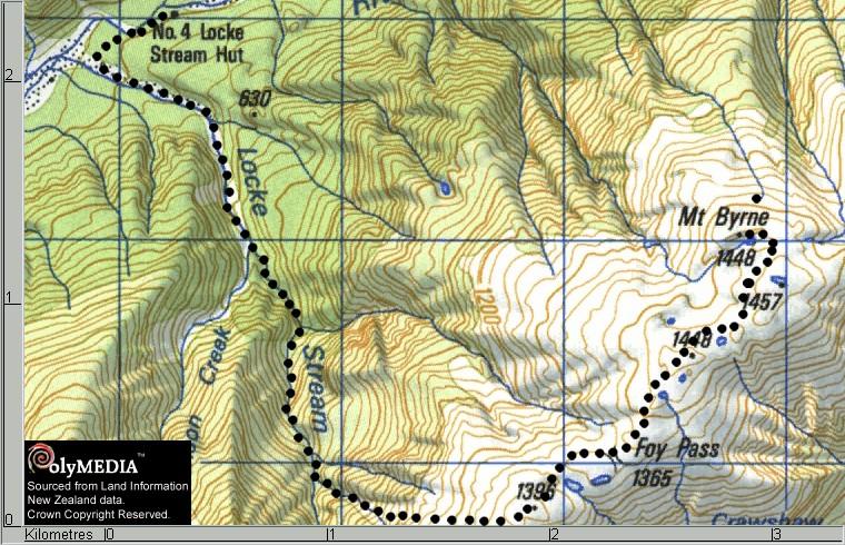
Follow Locke Stream well up until the scrub thins and then take the easiest looking gut on to the ridge South of Foy Pass. Then follow the rolling tussock ridge to the Summit ( which strangely is not quite the highest ground around!---you may miss it)


Add Place Add Route
Comments
Attribution
Stewart Robertson
UUID
 
18d96286-95b0-40e3-9d19-47958c20d42f