Map
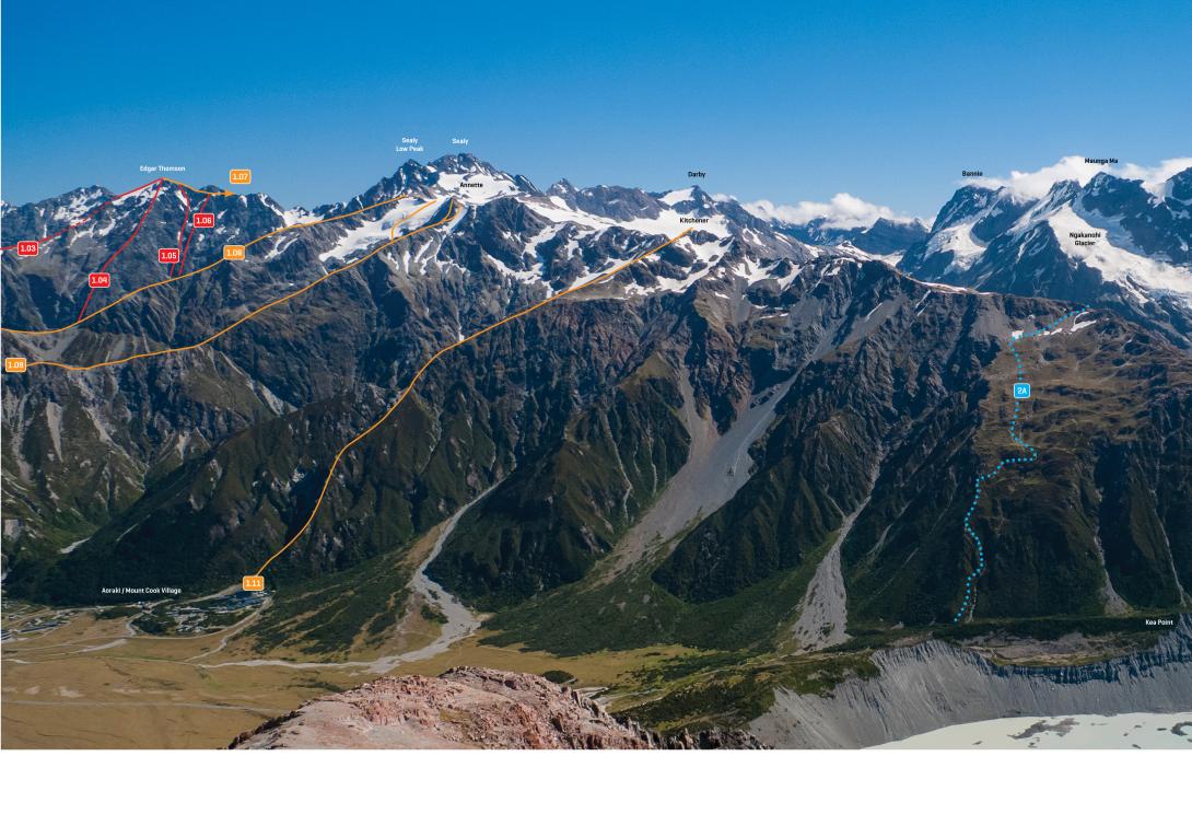
The Sealy Range from Mt Wakefield, January 2013.
Routes
| Reference | Title | Grade | Length | Pro | Quality | Alert | Operations |
|---|---|---|---|---|---|---|---|
| 1.08 | 1.08Hoophorn Spur, II,1+ | II,1+ | 0m | ||||
|
Leads to the edge of the upper Annette Plateau. Not as steep as Sebastopol Ridge at the top, but requires careful route-finding low down to avoid thick scrub. Descend via the Mueller Hut track, be prepared for a very long day. Shave up to 6 hours off the trip by going up on the true right of Hoophorn Stream from the end of the 4WD track, up until about 980m altitude. Then start walking up the scree slope between the two contributaries on the true left, between which the word "Hoophorn Stream" is printed in blue on the topomap, aiming to meet the ridge between letters "p" and "h" of the word "Hoophorn Spur" printed in black on the topomap, west of Pt 1490. Beware, this slope is prone to avalanches in winter. Once on the ridge, follow the ridge to approximately 2060m altitude, and then follow the shelf that leads straight to Mount Annette on the right.
|
|||||||
| 1.09 | 1.09Sebastopol Ridge, II,2+ | II,2+ | 0m | ||||
|
This climb makes an enjoyable long day trip in summer when combined with a descent via Mueller Hut and Sealy Tarns.
|
|||||||
| From Mueller Hut, I,1 | I,1 | 0m | |||||
|
From Mueller Hut traverse keeping about 200m below Ollivier and Kitchener and then climb gradually up onto the Annette Plateau. There are two bumps on the eastern edge of the plateau, 500m apart. Mt Annette is the southern one.
|
|||||||