Mt Hutton is a large mountain that can be seen from practically the full length of the Cass valley, and demands more attention from climbers than it has so far received.
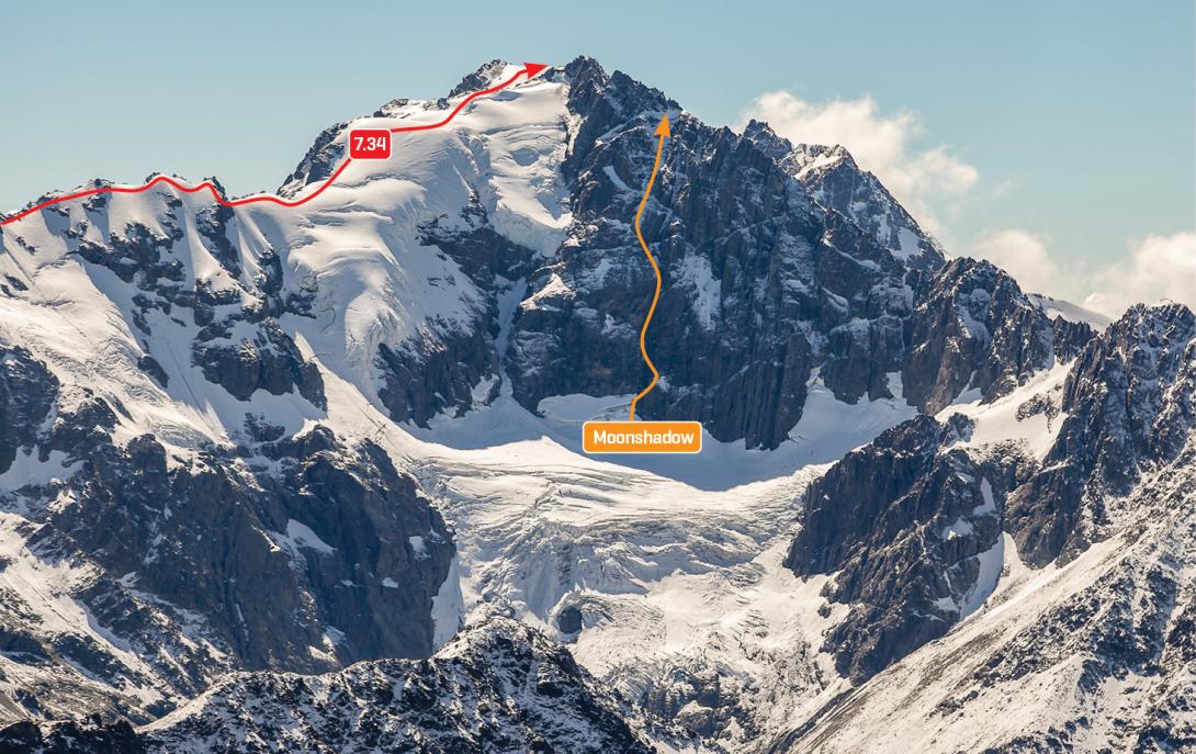
South face of Mt Hutton and the Faraday Glacier
Routes
| Reference | Title | Grade | Length | Pro | Quality | Alert | Operations |
|---|---|---|---|---|---|---|---|
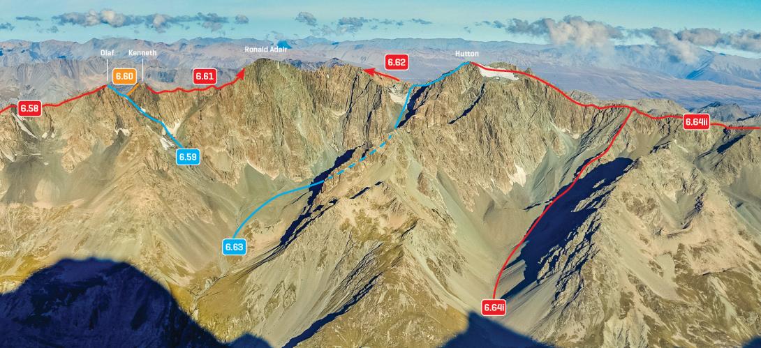
| 6.64 | 6.64South West Ridge, III,2 | III,2 | 0m | ||||
|
From the Murchison, head up beside the waterfall opposite the Baker Glacier, over grass and scree to the hanging valley west of the peak. Alternatively, if the moraine wall dictates, traverse into this valley from further north or south. Continue to the crest of the ridge using the rock rib between Pt 2554m and 2563m col, and then follow the ridge to the summit, traversing snow domes along the way.
|
|||||||
| 7.34 | 7.34Full South West Ridge, III,2 | III,2 | 0m | ||||
|
Gain Rutherford Pass and then continue almost 3km along the ridge to the summit. A great outing, probably best climbed when snow-covered. It would make a great ski tour.
|
|||||||
| Moonshadow, IV,5+ | IV,5+ | 0m | |||||
|
Climb the centre of the rock wall on the south face above the Faraday Glacier.
|
|||||||
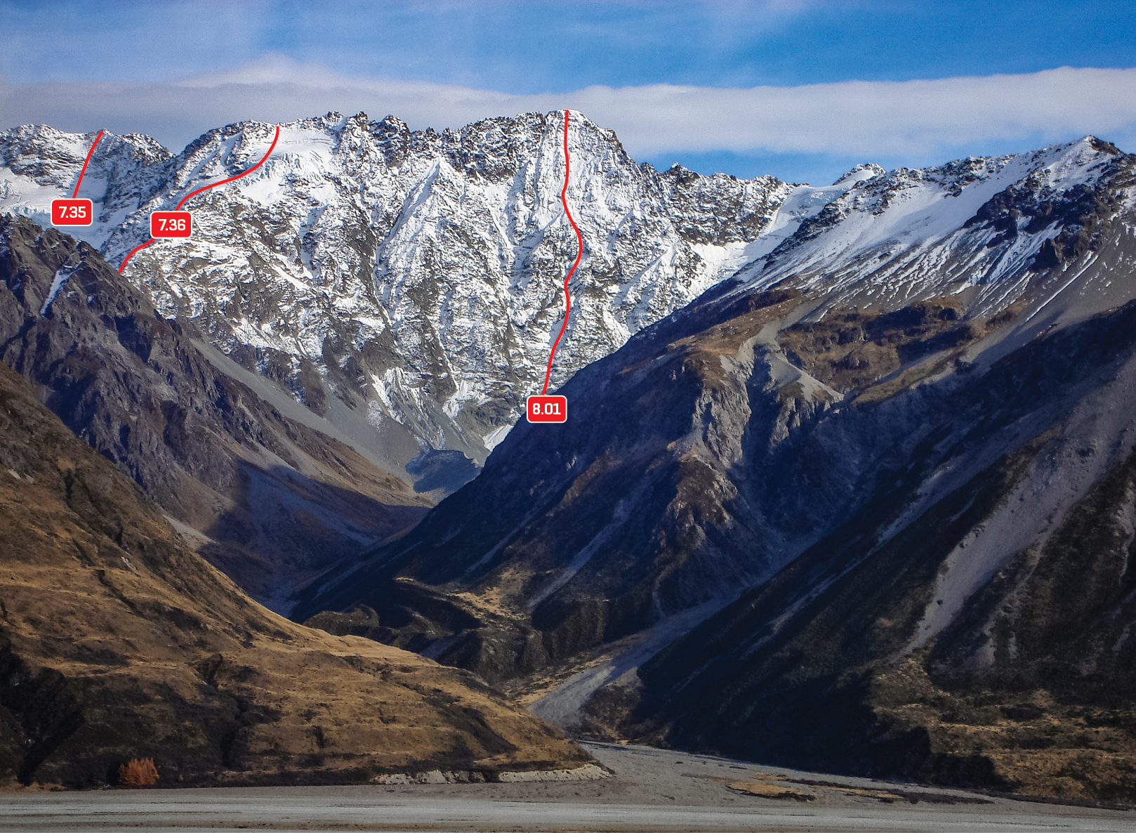
| 7.35 | 7.35East Face, III,3 | III,3 | 0m | ||||
|
Climbed from the Huxley Glacier up moderate snow slopes with some short rock steps. The first ascent party descended the north side of Mt Hutton, then climbed over the range south of Pt 2778m and down Rankin Ridge.
|
|||||||
| 7.36 | 7.36Rankin Ridge, III,2+ | III,2+ | 0m | ||||
|
From Rankin Pass, scramble up the rock ridge to Pt 2373m, then ascend crevassed snow slopes to the range south of Pt 2778m.
|
|||||||
| 6.63 | 6.63North East Ridge, II,2 | II,2 | 0m | ||||
|
From the Murchison Glacier, scramble up moraine, grass, and scree to the snowfield north of the peak, and then climb a snow gully to the Hutton – Ronald Adair Col. Traverse south-west over the low peak to the high peak.
|
|||||||


