Godley Pass is slightly more difficult than the Armadillo Saddle route, due to steep slopes on the east side (grade II, 2).
First crossed by Otto Frind and Conrad Kain in March 1914.
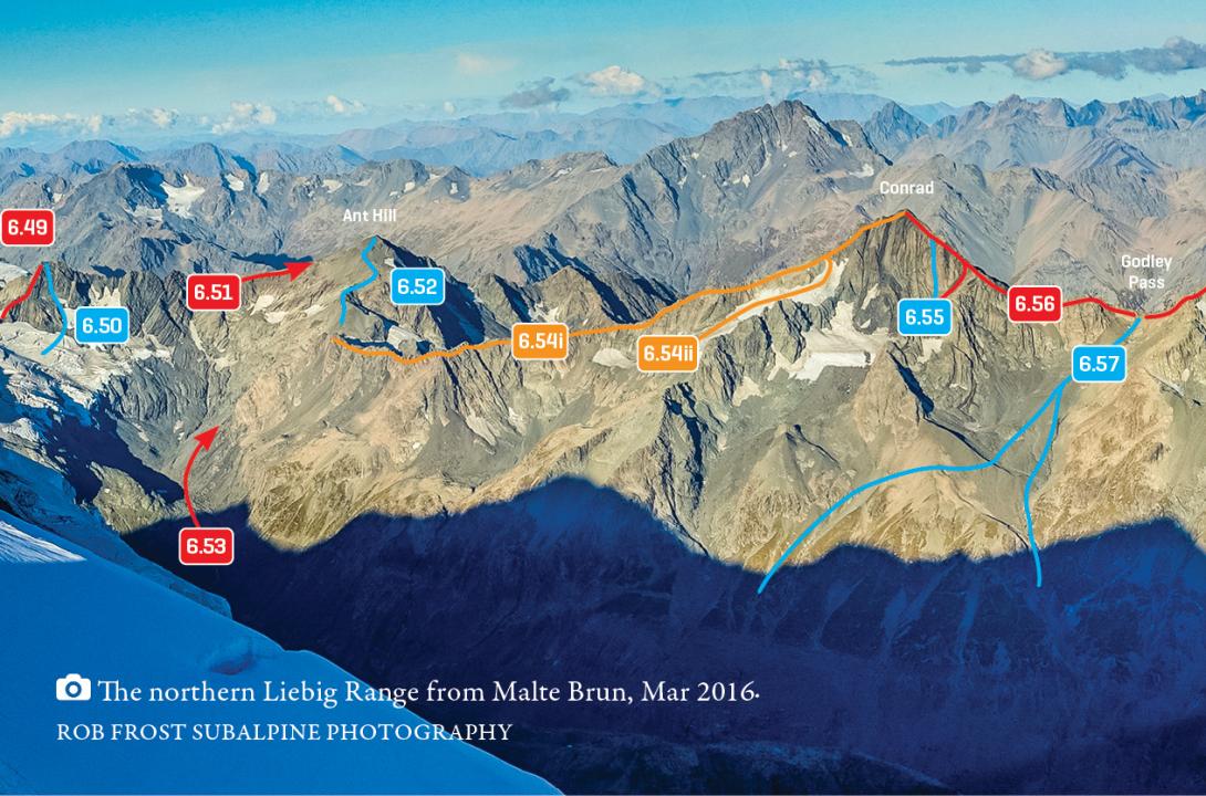
Liebig Range from Mt Richmond to Godley Pass, March 2016
From the Murchison: Route 6.57 on topo. Ascend the moraine wall either near Sunset Falls (which may no longer be feasible), or beneath the west face of Conrad (has been used more recently without trouble). Then climb up scree and snow to the pass. The descent to the south branch of the Rutherford Stream is long and steep but not complicated.
From the Godley: From the south branch of Rutherford Stream, ascend the long steep slope to the pass. Descend to the Murchison moraine wall over snow, scree, and tussock beneath the west face of Conrad.