Type
Mountain
Altitude
2042m
Part of
Map
Image
Caption
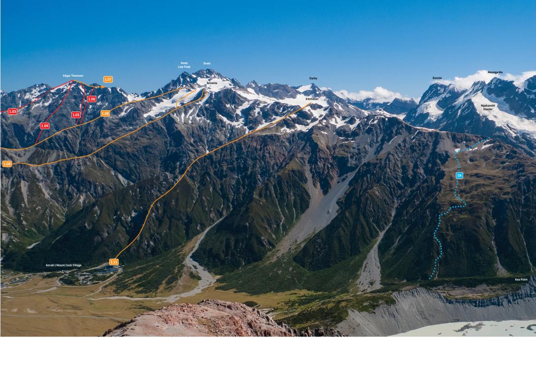
The Sealy Range from Mt Wakefield, January 2013.
Rights credit
Rob Frost/Subalpine Photography
Routes
| Reference | Title | Grade | Length | Pro | Quality | Alert | Operations |
|---|---|---|---|---|---|---|---|
| 1.11 | 1.11Watertank Ridge, I,2 | I,2 | 0m | ||||
|
Starts directly from the watertanks above the Hermitage, accessed via the Glencoe track. There’s some light scrub to push through low down, and later a few sections of exposed scrambling. The step 100m below the top is climbed using a right-to-left ledge system. Descend via Mueller Hut and Sealy Tarns. A great day out.
|
|||||||
| From Mueller Hut, I,2 | I,2 | 0m | |||||
|
Up easy rock from the slopes behind Mueller Hut. There are numerous variations. Take care if cloud comes in while you’re out – the hut is harder to find when descending than you think. The ridge from Ollivier to Kitchener has some very exposed sections, but is not technically difficult.
|
|||||||
Comments
This place appears in
Attribution
Rob Frost, ATP, 2018
UUID
08088325-245e-4190-b144-d740b15082ef