Type
Altitude
2818m
Part of
Image
Caption
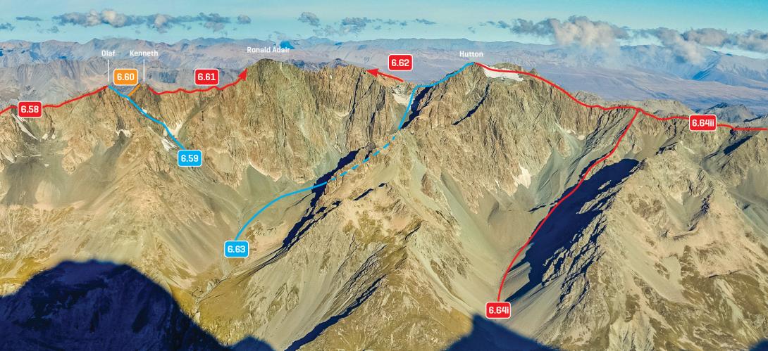
Liebig Range, Mt Olaf to Mt Hutton, March 2016
Rights credit
Rob Frost/Subalpine Photography
Lat/lon
-43.592062,170.400919, NZ Topo Map
Accessed from
Routes
| Reference | Title | Grade | Length | Pro | Quality | Alert | Operations |
|---|---|---|---|---|---|---|---|
| 6.61 | 6.61North Ridge, III,2+ | III,2+ | 0m | ||||
|
From the summit of Mt Kenneth follow the loose rock ridge with the odd snow patch to the summit.
|
|||||||
| 6.62 | 6.62South Ridge, II,2 | II,2 | 0m | ||||
|
From the Murchison Glacier, scramble up moraine, grass, and scree to the snowfield north of the peak, and then climb a snow gully to the Hutton – Ronald Adair Col. From the col, a fairly long, undulating scramble over loose rock leads to the summit.
|
|||||||
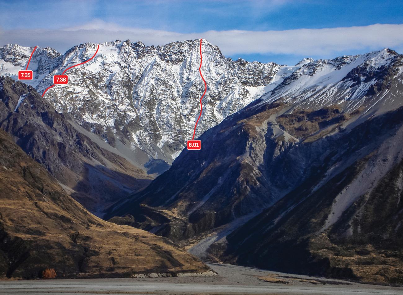
| 8.01 | 8.01East Face, III,3 | III,3 | 0m | ||||
|
Takes a line straight up the middle of the face, direct to the summit. Described by the first ascentionists as ‘straightforward snow and ice slopes with a couple of rock sections’.
|
|||||||
Images
Comments
This place appears in
Attribution
ATP 2018 (Rob Frost)
UUID
a24fd78d-c127-4646-84b4-f3707b4b8dff