Map
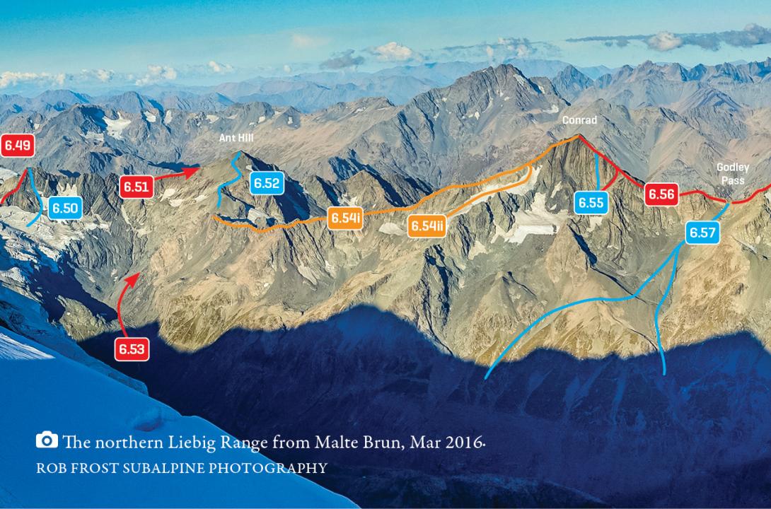
Liebig Range from Mt Richmond to Godley Pass, March 2016
Routes
| Reference | Title | Grade | Length | Pro | Quality | Alert | Operations |
|---|---|---|---|---|---|---|---|
| 6.54 | 6.54North Ridge, II,3 | II,3 | 0m | ||||
|
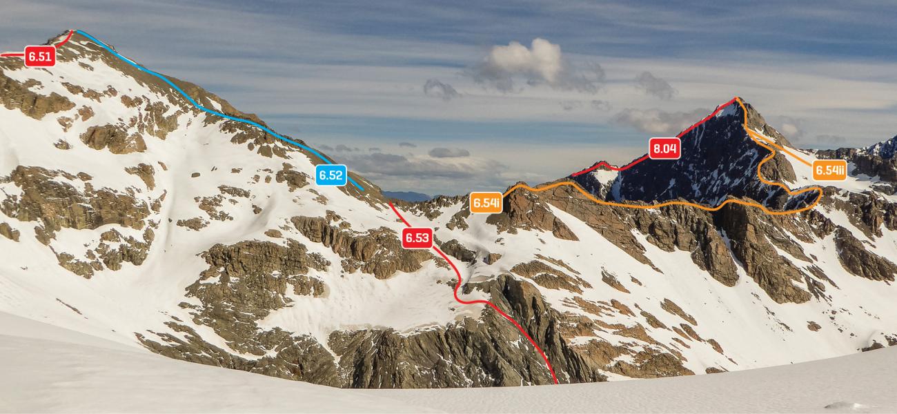
From slopes west of Armadillo Saddle, either (i) traverse below the ridge crest on scree and snow slopes, gaining access to the ridge roughly 200m from the summit or alternatively (ii) stay on the crest all the way from Armadillo Saddle. Two rock steps near the summit offer good quality climbing.
|
|||||||
| 6.55 | 6.55West Face, II,4,14 | II,4,14 | 300m | ||||
|
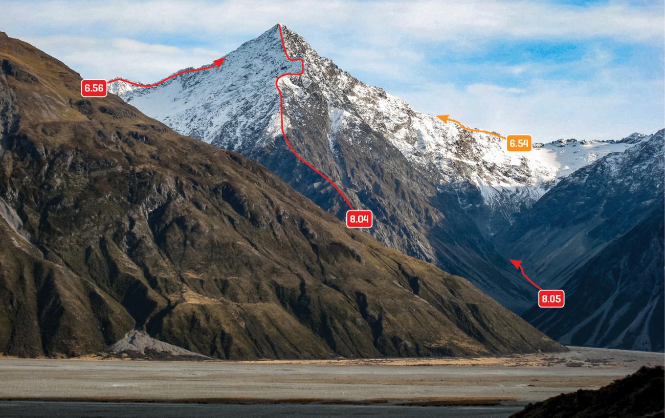
The basin below Conrad’s west face can be reached directly from the Murchison via a straightforward moraine wall (2012), or via a sidle from Armadillo Saddle at around 1800m to 2100m. The face involves 300m of pleasant rock. The first ascent party descended the South Ridge.
|
|||||||
| 6.56 | 6.56South Ridge, II,2 | II,2 | 0m | ||||
|
From Godley Pass, scramble up the rock ridge over the 2400m peak to the summit, or access the ridge from the basin below the west face. This is the easiest descent route.
|
|||||||
| 8.04 | 8.04East Ridge, III,3+ | III,3+ | 0m | ||||
|
A great line. The climbing consists of technical rock scrambling with sustained exposure. The rock quality is unknown. The South Ridge probably offers the best descent option.
|
|||||||
Images