An excellent viewpoint which few people visit.
Map
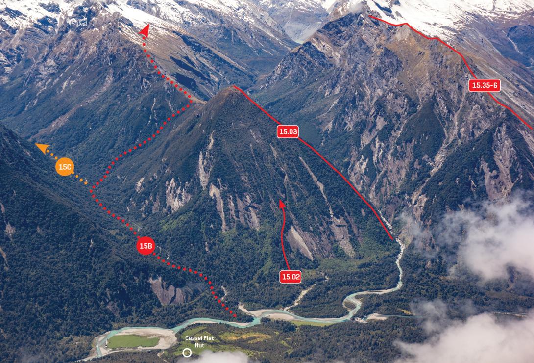
Cassel Flat and Conical Hill, November 2017
Routes
| Reference | Title | Grade | Length | Pro | Quality | Alert | Operations |
|---|---|---|---|---|---|---|---|
| 15.02 | 15.02Cassel Face, I,2+ | I,2+ | 0m | ||||
|
Pick a line that firstly avoids overlaps, and secondly avoids as much scrub as possible. Not recommended.
|
|||||||
| 15.03 | 15.03South West Spur, I,1+ | I,1+ | 0m | ||||
|
Starting on the true right of the Douglas River at the downstream end of the gorge, bush bash up the spur directly to the summit. The first ascent party used an ascending sidle on the Douglas faces, slightly south of the spur. This route was blazed in 1951, which enticed enough people to the area to result in 17 people at Harpers Rock for a few days in early 1952! Traces of any route nowadays would be difficult to find. Not recommended.
|
|||||||
| 15.04 | 15.04East Ridge, I,1 | I,1 | 0m | ||||
|
Follow the marked route which follows up Regina Creek and then climbs to Conical Hill Saddle. The ridge is scrubby but straightforward – follow animal trails where possible. Possibly first ascended by Ian Loach in 1948.
|
|||||||