Type
Mountain
Altitude
2517m
Part of
Map
Accessed from
Image
Routes
| Reference | Title | Grade | Length | Pro | Quality | Alert | Operations |
|---|---|---|---|---|---|---|---|
| SR | SRSouth Ridge, II,2+ | II,2+ | 0m | ||||
|
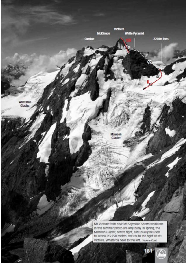
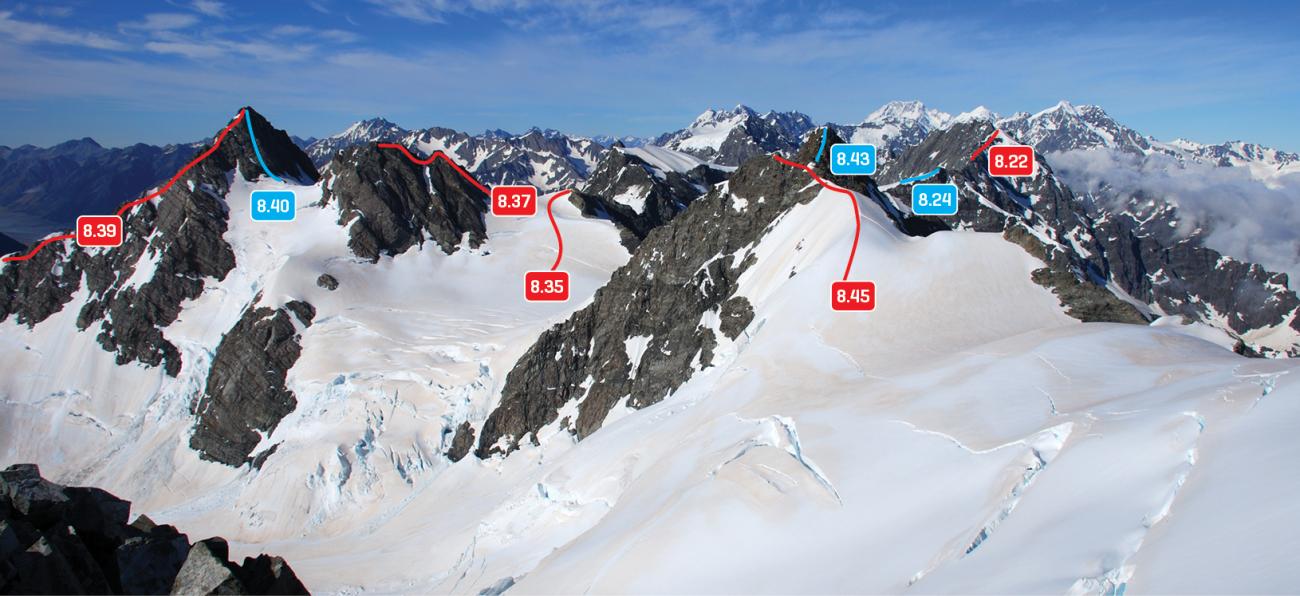
From the Neish Plateau, ascend snow slopes between White Pyramid and Victoire then climb snow and rock to the summit.
|
|||||||
| 8.43 | 8.43East Ridge, II,2 | II,2 | 0m | ||||
|
From the Neish Plateau, climb to the col east of low peak, then follow the Main Divide. Can also be approached via Gorrie Peak/Pt 2486m. First ascent unknown.
|
|||||||
| IL | ILFrom Ice Lake, 2- | 2- | 0m | ||||
Up the Mawson Glacier to the Divide pass at 2250 metres, then continuing over White Pyramid |
|||||||
Images
Comments
This place appears in
Attribution
ATP 2018 (Rob Frost)
CW Alps 2009 (Geoff Spearpoint, Yvonne Cook, CMC)
CW Alps 2009 (Geoff Spearpoint, Yvonne Cook, CMC)
UUID
e2017852-49eb-478e-b93c-2ceaa47f6ab4