Mt Jean, Mt Jeanette (partly obscured) and Mt Darby from upper Sladden Glacier, July 2011
Routes
| Reference | Title | Grade | Length | Pro | Quality | Alert | Operations |
|---|---|---|---|---|---|---|---|
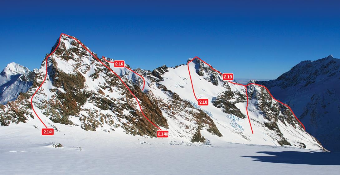
| 2.18 | 2.18East Flank, II,1+ | II,1+ | 0m | ||||
|
Follow the snow slope to the ridge east of the summit.
|
|||||||
| 2.19 | 2.19North Ridge, II,2+ | II,2+ | 0m | ||||
|
This ridge can be reached at almost any point, but the best is probably the small col around 2390m. Rock scrambling on a blocky ridge leads to the summit.
|
|||||||
| North West Flank, I,2+ | I,2+ | 0m | |||||
|
From Barron Saddle via the Williams Glacier. Climb the rib up the middle of the face.
|
|||||||
| West Ridge, I,2 | I,2 | 0m | |||||
|
Gain the ridge from the true left edge of the Williams Glacier. Exposed rock scrambling, similar in difficulty to the North Ridge.
|
|||||||
| Bengal, 12,4- | 12,4- | 0m | |||||
|
Access to the south face of Mt Darby is easy, descend from Barron Saddle,
|
|||||||