
Pt 2198

Type
Altitude
2198m
Part of

na

Image
Lat/lon
-43.443821,170.411682, NZ Topo Map
Topo50
BW19 584 160
Add Place Add Route

Routes

Reference Title Grade Length Pro Quality Alert Operations
 West Ridge, 1+ 1+ 0m
0

  • P1
  • Alpine (Mt Cook) 1+

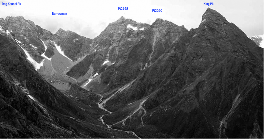
From the lower Barrowman Valley, scramble up onto this rocky ridge. Higher up, a snowfield
gives a break, and there is enjoyable climbing on weatherworn rock slabs. Mixed ground then
leads to the low peak. There is a descent and considerable climb from the low to the high peak
and, on the first ascent, the route led north across a snowfield to a col on the North Ridge. Easy
scrambling along that leads to the high peak.


 North Ridge, 2- 2- 0m
0

  • P1
  • Alpine (Mt Cook) 2-

From the Butler River South Branch, ascend the snow gully that leads directly to the col
between Pt 2198 metres and Pt 2020 metres and continue to the summit.


 South Ridge, 1+ 1+ 0m
0

  • P1
  • Alpine (Mt Cook) 1+

From the Butler River South Branch head up the gully under the col at Pt 1838 metres, then
north up snow slopes. From about the height of the col swing back to the left across broad
ledges, a gully and steeper rock to the vicinity of the col itself. Follow up the South Ridge.


Comments
Attribution
Yvonne Cook and Geoff Spearpoint,
in association with the Canterbury Mountaineering Club
UUID
 
3e7239a6-fbcd-4136-bde8-c5b508c30131