Type
Altitude
1850m
Part of
Map
Accessed from
Image
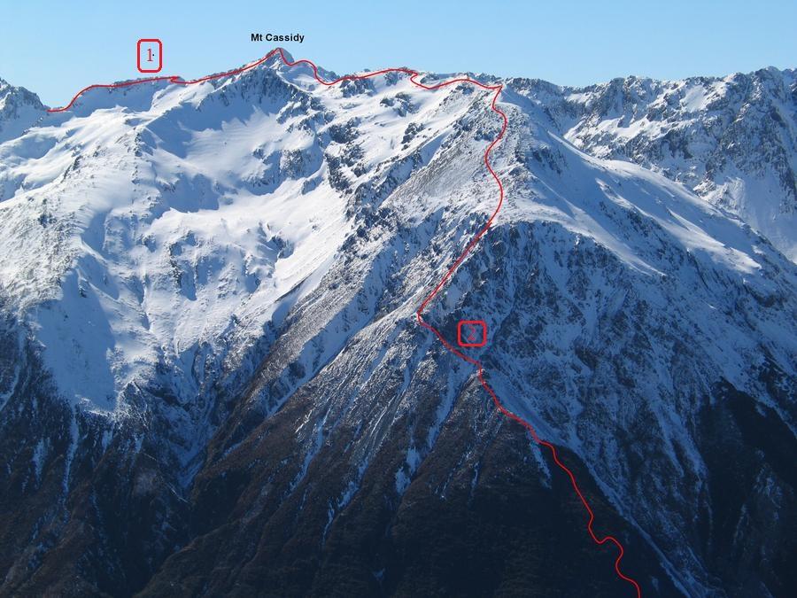
Routes
| Reference | Title | Grade | Length | Pro | Quality | Alert | Operations |
|---|---|---|---|---|---|---|---|
| 1 | 1From Temple Basin, 1 | 1 | 0m | ||||
Easy climbs from Temple Basin. Follow the Cassidy ski tow to gain the area south of Bill’s Basin. |
|||||||
| 2 | 2Via Cons Track, 1 | 1 | 0m | ||||
Reached via Cons Track, which ascends on the Southwest Ridge from the Bealey River crossing on the Punchbowl Falls track. Once the bushline is reached continue ascending the ridge on loose rock. At the base of the bluffs, a rough trail sidles northwards ascending slowly under the bluffs. After 250 metres a steep scree gully is reached. Ascend this to the easier boulder slopes of the main ridge. |
|||||||
Comments
Attribution
Photo; Graeme Kates
UUID
fec2cbf1-ebdd-435f-9695-9ff01bb8786f