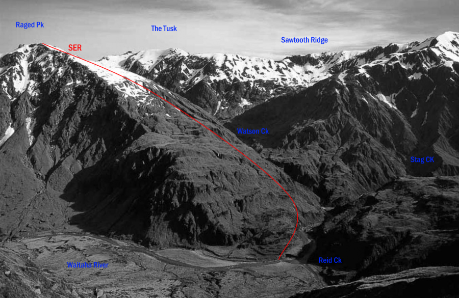
Type Mountain Altitude 1943m Part of Hitchin Range Map Lat/lon-43.116711,170.870962, NZ Topo Map Topo50 BW18 268 240 Accessed from Waitaha River Image Routes Reference Title Grade Length Pro Quality Alert Operations SER SERSouth East Ridge 0m 0 Rate P1 The Waitaha is easily crossed just below the Reid–Stag Creek forks to reach the ridge. Descending, aim just upstream of the Reid–Stag Creek junction – the bottom of the slope south of Pt 1328 metres is cut by a continuous band of bluffs. Add Place Add Route Log in to post comments Comments Attribution Yvonne Cook and Geoff Spearpoint, in association with the Canterbury Mountaineering Club UUID 6400ff61-a603-46fa-b13e-321ff067a6e5