Type
Altitude
2089m
Part of
na
Image
Lat/lon
-43.455972,170.414085, NZ Topo Map
Topo50
BX16 908 853
Accessed from
Routes
| Reference | Title | Grade | Length | Pro | Quality | Alert | Operations |
|---|---|---|---|---|---|---|---|
| Original Route, 1 | 1 | 0m | |||||
This rock peak can be climbed up extensive slabs from the stream below Lake Barrowman. Snow |
|||||||
| West Face | 0m | ||||||
A route on slabs from Barrowman Stream. |
|||||||
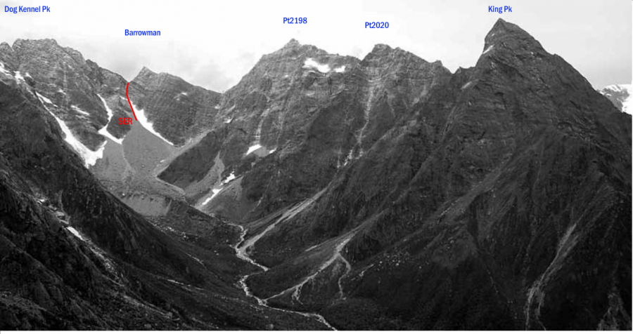
| SER | SERSouth East Ridge, 2 | 2 | 0m | ||||
From the South Butler Valley, head straight up a snow gully then rock east of Mt Barrowman |
|||||||
Comments
Attribution
Yvonne Cook and Geoff Spearpoint,
in association with the Canterbury Mountaineering Club
in association with the Canterbury Mountaineering Club
UUID
e5cda14d-dfa0-4f0c-9563-adbd252ff225