Type
Altitude
2132m
Part of
Urquhart Peak is named after the Urquhart family who managed Algidus Station in the 1920s and 1930s.
Map
Accessed from
Image
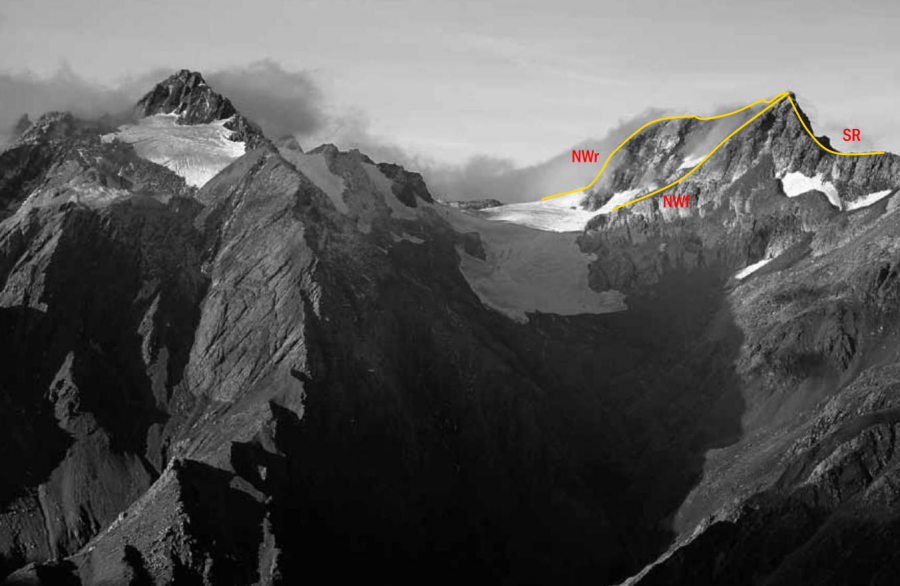
Routes
| Reference | Title | Grade | Length | Pro | Quality | Alert | Operations |
|---|---|---|---|---|---|---|---|
| NWr | NWrNorth West Ridge | 0m | |||||
|
Originally reached from the long ridge commencing from the confluence of the North Mathias River and Canyon Creek.
|
|||||||
| NWf | NWfNorth West Face, 1+ | 1+ | 0m | ||||
|
From the West Mathias River, follow the side creek draining Urquhart Peak to a basin at its head. From here climb mixed snow and rock to the top.
|
|||||||
| SR | SRSouth Ridge | 0m | |||||
|
From the West Mathias River, follow the side creek draining Urquhart Peak. Before gaining the basin at the head of the creek follow a rock spur leading to the South Ridge. Scramble up the ridge, negotiating a steep tricky step before the summit.
|
|||||||
Comments
Attribution
Yvonne Cook and Geoff Spearpoint,
in association with the Canterbury Mountaineering Club
in association with the Canterbury Mountaineering Club
UUID
10bcf76f-eddf-4bb6-b6d1-8b123c584fc6