Type
Altitude
2454m
Part of
Mt Ramsay is on an eastern spur of the Divide.
Lat/lon
-43.271831,170.880919, NZ Topo Map
Topo50
BW18 280 068
Accessed from
Routes
| Reference | Title | Grade | Length | Pro | Quality | Alert | Operations |
|---|---|---|---|---|---|---|---|
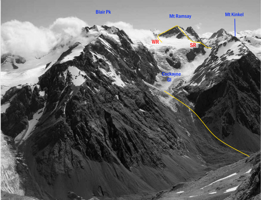
| WR | WRWest Ridge, 2 | 2 | 0m | ||||
Reach the West Ridge from the upper Cockayne Glacier and scramble to the summit. Follow straightforward slopes from a col between Mt Westland and Mt Ramsay. |
|||||||
| SR | SRSouth Ridge, 2+ | 2+ | 0m | ||||
Gain the South Ridge from the upper Cockayne Glacier. The rock is poor in places. Under good snow conditions the loose rock of the South Ridge can be reached via the St James Glacier. |
|||||||
| NE | NENorth East Ridge | 0m | |||||
From the Clarke moraine climb up a ridge between the Clarke and Ramsay Glaciers and continue along rock and snow to the summit. |
|||||||
Images
Comments
Attribution
Yvonne Cook and Geoff Spearpoint,
in association with the Canterbury Mountaineering Club
in association with the Canterbury Mountaineering Club
UUID
5b87531a-542d-46b5-b723-38b9ec31e874

