Type
Altitude
60m
Part of
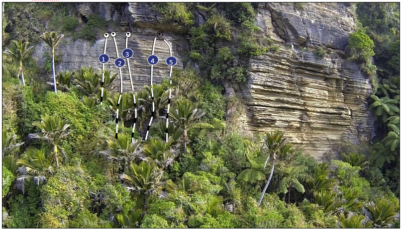
Pita Pata Wall is hidden in the bush high up above the Punakaiki River. It was developed in desperation on a rainy day - Bullock Creek was flooded and most other areas of rock were wet. It’s a wee walk up to the crag, but it stays dry in any weather and the views out to sea are stunning!
Image
Walktime
10 mins
Lat/lon
POINT (171.340177 -42.126779)
Access
Park just before the 2nd gate. Head right up through a grassy clearing and look for a marked track in the bush. Cross under a wire and up to the base of a chossy cliff. Follow this around to Pitapata Wall.
Routes
| Reference | Title | Grade | Length | Pro | Quality | Operations |
|---|---|---|---|---|---|---|
| 1 | Rain Dance | 16 | 12m | 4 |
||
| 2 | Gumboot Route | 15 | 12m | 6 |
||
| 3 | The Darkness Comes | 17 | 14m | 6 |
||
| 4 | Inspiration Exploration | 17 | 14m | 6 |
||
| 5 | Pitta Patta | 16 | 14m | 6 |
Comments
Attribution
Neil Warrington & Neil Silverwood, http://www.kiwitracks.com/paparoa/
UUID
7c761902-4aa9-4829-8591-71ce0290af7b