Map

Routes
| Reference | Title | Grade | Length | Pro | Quality | Alert | Operations |
|---|---|---|---|---|---|---|---|
| 2.49 | 2.49South East Face, V,3 | V,3 | 0m | ||||
|
Direct from the Mueller Glacier to the Ngakanohi Glacier and continue up the East Rib to the summit. Glacial retreat since the first ascent has made the lower part of this climb loose, unpleasant, and quite dangerous. This route will only get worse with increased glacial retreat. It’s included here more from a historical view point. Not recommended.
|
|||||||
| 2.50 | 2.50Ngakanohi Glacier Route, III,2+ | III,2+ | 0m | ||||
|
From the Frind-Mueller confluence, ascend part way up the true right edge of the lower Frind Glacier, then climb left along rock ledges to gain the base of the Ngakanohi (‘the eyes’) Glacier above Ngaroimata (‘the tears’) Falls. Traverse diagonally up to the top of the glacier to join the East Rib of Maunga Ma, which is followed direct to the summit up rotten rock (covered by snow early in the season).
|
|||||||
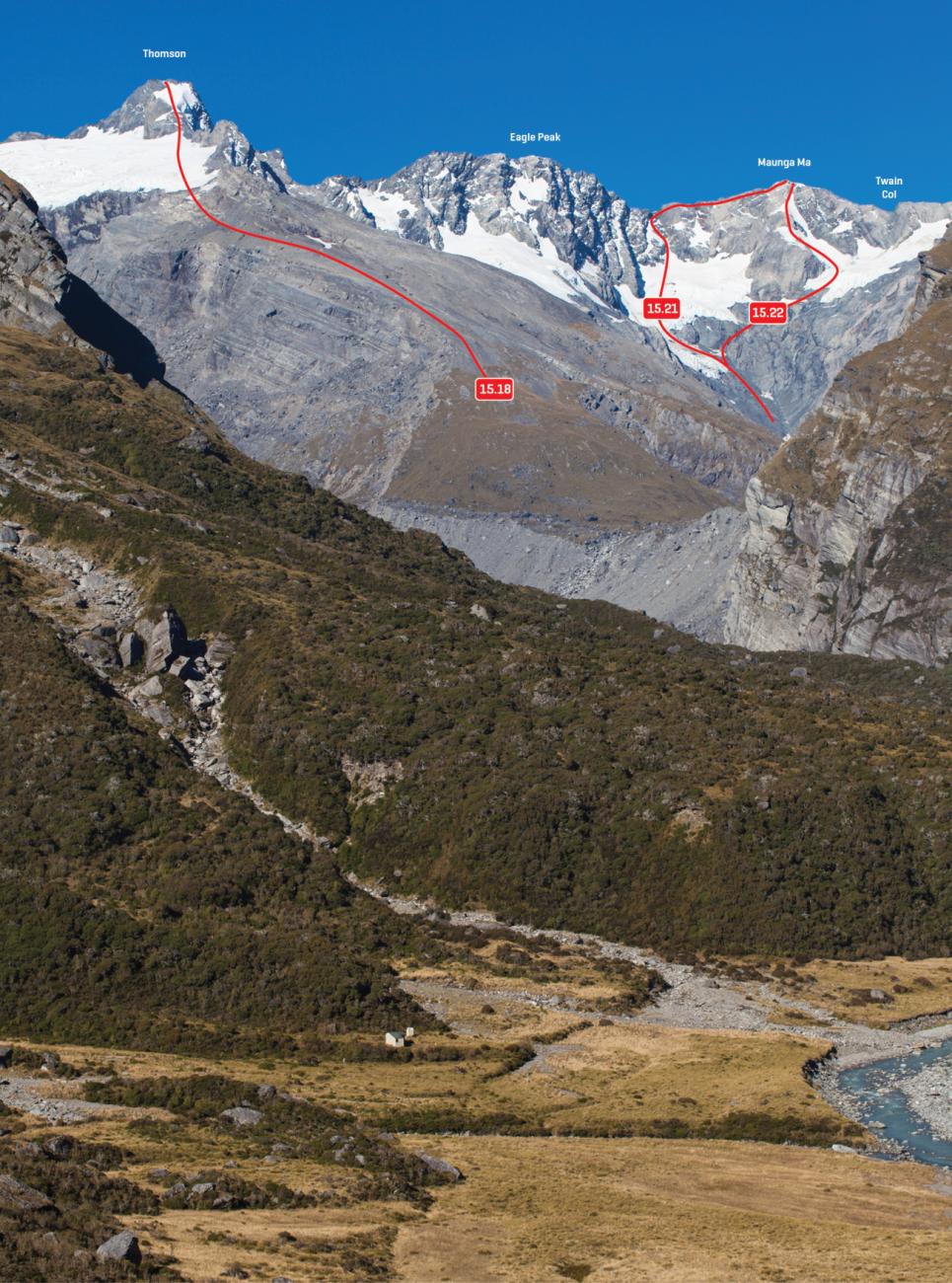
| 15.21 | 15.21North Ridge, III,2+ | III,2+ | 0m | ||||
|
From the Fitzgerald lake, climb to the 2416m col then follow the ridge to the summit. The route of the first full ascent from the west.
|
|||||||
| 15.22 | 15.22West Face, III,2+ | III,2+ | 0m | ||||
|
From the Fitzgerald lake, climb towards Twain Col then climb moderate snow slopes up a blunt ridge direct to the summit.
|
|||||||
| 15.23 | 15.23Vervoorn Vamoose, III,2 | III,2 | 0m | ||||
|
A descending route from Maunga Ma to the Fitzgerald Flats via a diagonal shingle bench below Awatea has been used when the descent from Maunga Ma to the Mueller was obscured by inclement weather. This is technically straightforward, but it could be difficult to stay on route.
|
|||||||
Images