Type
Mountain
Altitude
1976m
Part of
Mt Whaitiri is located incorrectly on old topomaps.
Map
Accessed from
Image
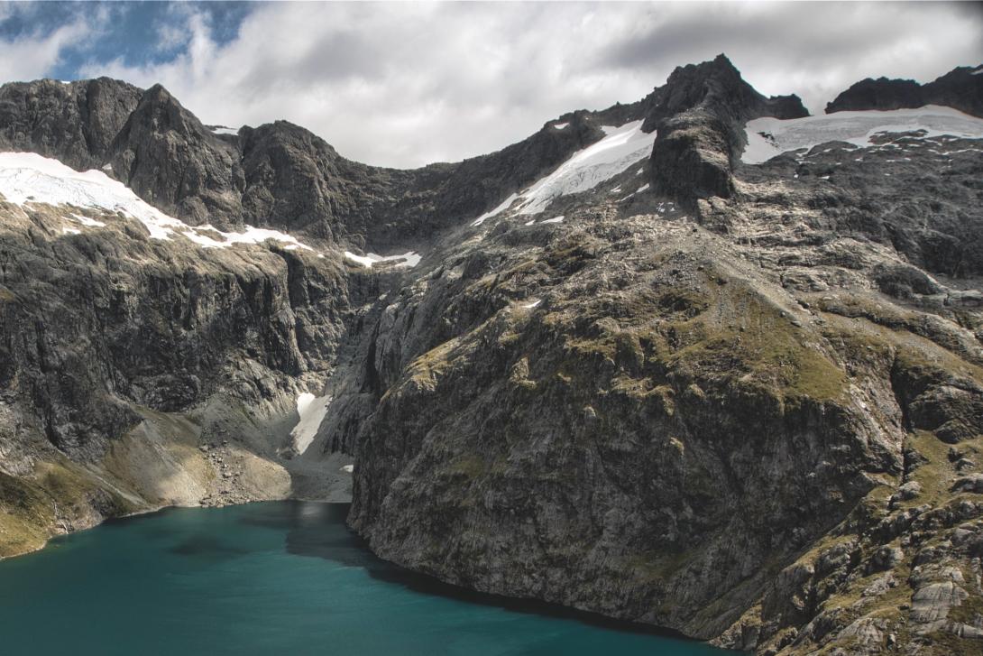
Caption
Mt Whaitiri (top right) above Lake Turner. Pakihaukea Pass is to the right.
Routes
| Reference | Title | Grade | Length | Pro | Quality | Alert | Operations |
|---|---|---|---|---|---|---|---|
| East Ridge, II,2+ | II,2+ | 0m | |||||
|
The broad ridge narrows up high with a notch providing the crux. Climbed as part of an ice-axe free crossing of the central Darrans, but may have been climbed before.
|
|||||||
| South Ridge, II | II | 0m | |||||
|
Traverse broad terraces above Lake Turner and then the snowfield south-east of Whaitiri. The ridge is easily reached and then followed to the summit.
|
|||||||
| North Ridge | 150m | ||||||
|
Climb the ridge from Pakihaukea Pass.
|
|||||||
Comments
Attribution
Craig Jefferies
UUID
0d0248d3-4134-41d5-aafc-edb64d9d0aee